Does your business need better internet?
Return to blog
5G
How to find 5G cell towers near you
Updated on August 6, 2025
Identifying the location of 5G cell towers is a challenge for businesses in rural and remote areas, despite the immense opportunities 5G connectivity offers. While enhanced data speeds, reduced latency, and greater bandwidth can significantly enhance business efficiency, profitability, and customer experiences, accessing these benefits hinges on locating the 5G cell sites.
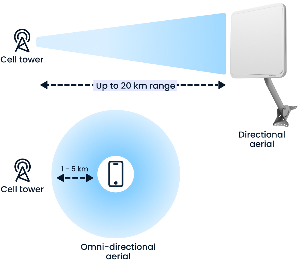
Rural areas often grapple with a lower density of cell towers, making reliable wireless communication challenging. Compared to urban environments, where small cell and microcell installations on utility poles, street lights, and rooftops are abundant, rural communities may rely more heavily on traditional macrocells and base stations. This sparse distribution can lead to connectivity issues and inadequate signal strength. It's crucial for telecom providers and users to position cellular antennas strategically, ensuring alignment with the nearest 5G towers to counteract these challenges.
5 ways to find 5G cell towers
1. Use online maps and directories
Cell tower map websites: One of the simplest methods of locating a 5G cell tower is to simply consult a map. Platforms like CellMapper and AntennaSearch provide comprehensive maps showing the locations of cellphone towers, including 5G cell towers. These maps are invaluable for identifying the closest cell towers by simply entering your address or current location. They also help you tune your cellular network by offering insights into frequency bands and radio frequency (RF) coverage.
Network provider maps: Major providers such as Verizon, AT&T, and T-Mobile offer detailed 5G coverage maps on their websites. These maps illustrate 5G deployment areas, assisting users in understanding where 5G networks are available and where expansion is planned. Checking these maps can help you decide which provider offers the best 5G coverage in your area.
2. Mobile apps for locating towers
Mobile apps like Network Cell Info Lite and OpenSignal are also excellent tools for locating nearby cell towers. These apps leverage GPS to show your current position along with the direction and distance to the nearest towers. Simply download and install one of these apps and follow the on-screen instructions to begin tracking cell tower locations, signal strength, and potential improvements for your 5G device. This can be done from one location, but is often even more effective on the move, an activity called wardriving. While this can be done for nefarious purposes, the term itself just refers to driving around and gathering network information.
Does your business need better internet?
Wardriving on mobile for more accuracy
Wardriving involves using mobile applications to detect wireless networks and cell tower signals while moving through an area, often in a vehicle. Here are the steps to optimize your wardriving experience:
Preparation and equipment:
The first step in wardriving involves installing specific apps on a mobile device. Apps such as Network Cell Info Lite, OpenSignal, or similar tools can be installed on Android phones to facilitate the detection of wireless networks and cell towers. Utilizing your phone’s GPS functionality is crucial for accurately mapping the locations of detected towers. In some cases, an external GPS device or a high-gain antenna might be used to enhance signal detection and accuracy.
Data collection:
As you move through different areas, the app you have chosen automatically scans and records information from detectable wireless networks and cell towers, including their unique identifiers and signal strengths. These applications log geolocation and signal data continuously, providing users with a detailed overview of network distribution across a geographic area.
Route planning:
For comprehensive data collection, plan a route that covers diverse terrains and density zones. This includes urban centers, suburban areas, and rural routes to ensure a thorough representation of network availability. Always prioritize safety by utilizing hands-free setups and only reviewing collected data when stopped in safe locations.
Analysis and mapping:
After collecting the data, wardrivers can analyze the information to create maps of cell tower locations, showing where mobile signal strength is optimal and where it may be lacking. The data can be uploaded to platforms like WiGLE’s online repository, where users collectively share and access the mapped information, thus expanding community knowledge of cellular networks.
Applications of wardriving:
Individuals and businesses can use wardriving results to optimize antenna positioning, choose the best wireless providers based on coverage, and even identify opportunities for additional infrastructure development. Telecommunications operators can also benefit from wardriving data to refine their publicly provided coverage maps and address network shortcomings.
3. Consulting with your service provider
Engaging directly with your telecommunications provider is another way to learn about nearby 5G cell towers. Providers often have access to more precise data and can offer personalized advice on antenna positioning and equipment upgrades. This direct communication can also reveal any future infrastructure developments planned for your area.
4. Crowdsourced data for coverage
Crowdsourced platforms like Ookla Speedtest can offer real-world data about 5G signal availability. Users upload their signal strength experiences, which are then compiled into coverage maps. This data can be instrumental in gauging effective 5G coverage areas and deploying your 5G technology setup accordingly.
5. Community and forum insights
Online forums and social media groups focused on 5G technology are also great sources of information because participants often discuss tower locations and signal optimization strategies. They provide anecdotal insights and FAQs on health concerns associated with 5G radio waves, drawing from research published by organizations like the World Health Organization and the Federal Communications Commission (FCC). These communities can be a valuable resource for those seeking firsthand experiences. Reddit, Facebook, and LinkedIn can all be valuable sources of insight for technical and analytical expertise, as well as firsthand and anecdotal experience.
Take full advantage of rural 5G with Inseego solutions
As an industry leader in 5G, we provide solutions optimized to take full advantage of 5G’s advanced capabilities under any and all circumstances.
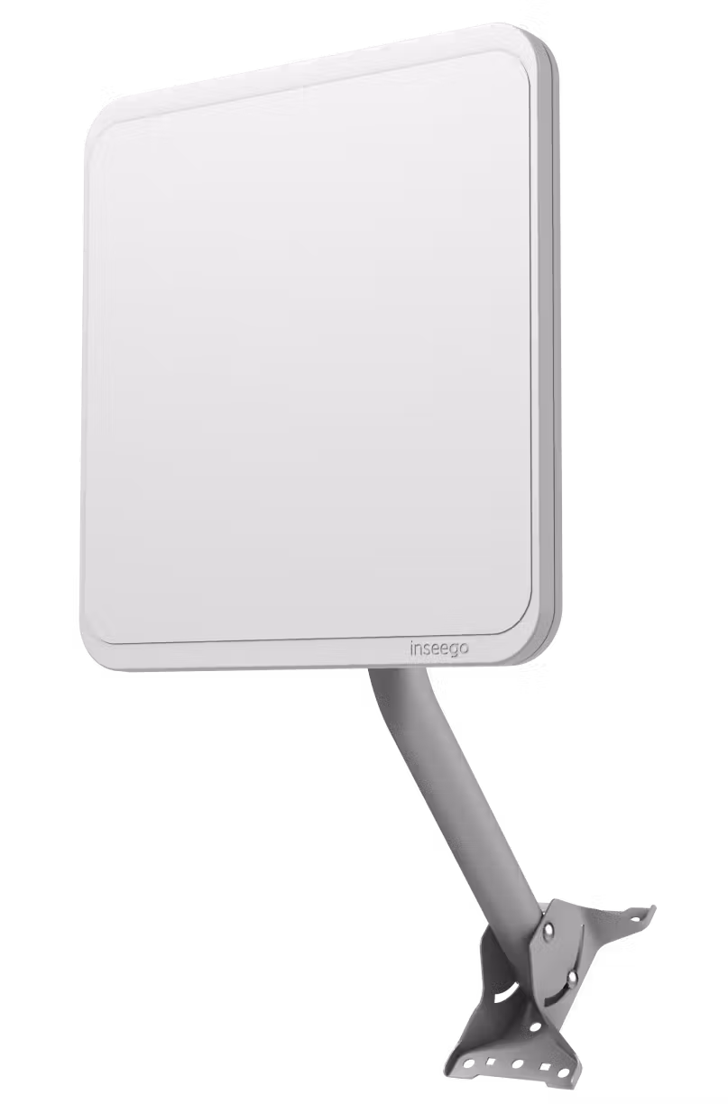
Our outdoor CPE cellular antennas are designed to capture cellular signals from 5G cell towers and convert them into robust internet connectivity for homes and businesses in remote and rural areas. This dynamic conversion process allows users in rural areas to access high-speed internet, which was once hindered by the limitations of fixed-line broadband or satellite internet services. By directly connecting to 5G towers, user devices minimize latency and maximize throughput, ensuring seamless streaming, faster downloads, and stable video conferencing capabilities.
With multi-directional antennas and as much as 10-20km of network coverage, our CPEs are specifically engineered to capture high-quality 5G no matter where your business operates. Advanced weatherproofing for temperature, moisture, and dust ensures that once deployed, they continue functioning under any circumstances. Inseego devices outperform traditional satellite internet solutions, which often suffer from delays and inconsistent performance. These devices can improve signal reception and transmission and support a sustainable telecommunications infrastructure tailored to the unique challenges of rural environments.
To learn more about how our cellular antennas can support your rural or remote business, contact us today.
Talk to our experts!
Set your customers or business up with the fastest, most secure, easiest, most reliable fixed wireless solutions.